Next Gen
Land Cover AI
Transform raw Landsat 8 satellite imagery into professional classification maps in minutes. Powered by Deep Learning, optimized for ArcGIS Pro.
Trusted by GIS Analysts worldwide

Tool Interface
Native ArcGIS Pro Geoprocessing Tools.
1. Clean Toolbox Structure
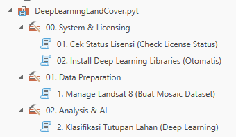
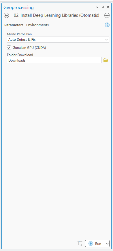
2. Auto-Install Libraries
3. Smart Mosaic Engine
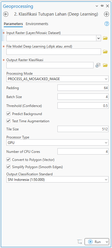
4. Deep Learning Classification
Why Deep Learning Tools?
Automate your remote sensing workflow with our enterprise-grade Python Toolbox for ArcGIS Pro.
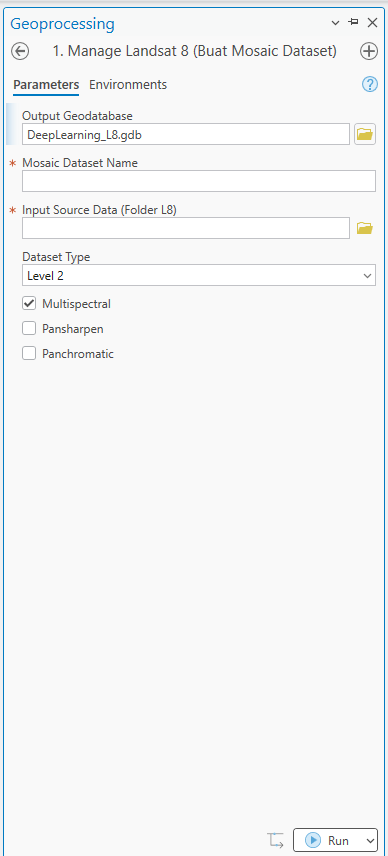
Smart Mosaic Engine
Automatically parses Level 1 & Level 2 Landsat metadata (_MTL.txt) to build robust mosaic datasets, even when standard tools fail.
Scientific Safety Lock
Prevents inaccurate classification by locking usage to Level 2 (Surface Reflectance) data, eliminating "Snow/Ice" hallucinations in tropical areas.
Auto-Vectorization
Converts raster output to seamless polygons instantly, complete with SNI (Indonesian Standard) attribute mapping and Area (Ha) calculation.
Choose Your Power
Start for free with our robust Mosaic Engine, or upgrade to Pro for AI Classification.
Mosaic Tool
Perfect for data preparation and organizing Landsat 8 Level 1 & Level 2 imagery.
- Smart Mosaic Engine
- Auto-check Dependencies
- Metadata Auto-Parsing
Includes .pyt toolbox only
Pro Edition
One-time payment. Upgrade to unlock AI Classification forever.
- Unlock Deep Learning Forever
- Auto-Vectorization (SNI Standard)
- Advanced GPU Optimization
- Lifetime Support & Updates
Data Pendukung (Wajib untuk AI)
Untuk menggunakan fitur Deep Learning Classification (Paket PRO / Trial), Anda perlu download file model AI pendukung berikut. File ini hanya perlu diunduh sekali dan diletakkan di folder yang sama dengan toolbox.
- • Ukuran: ~150 MB
- • Diperlukan untuk: Tool 02. Classify Land Cover